Project Statement
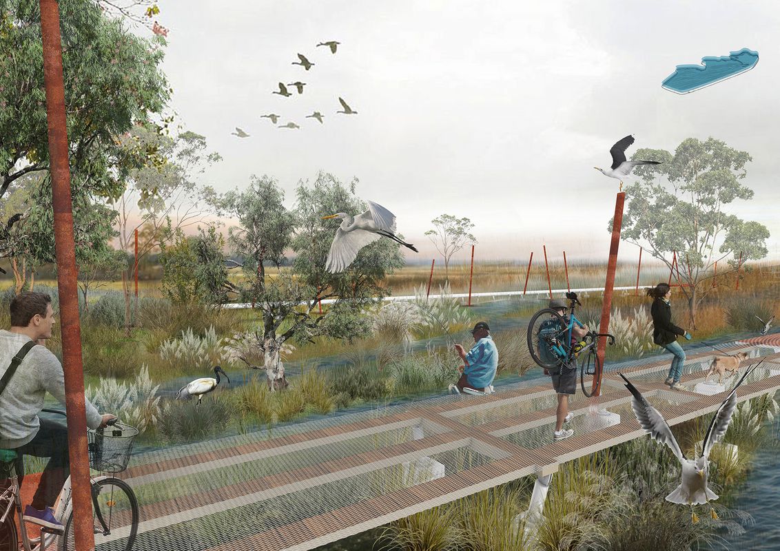
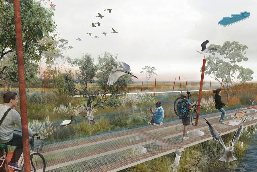
Globally, sea level rise is leading to the degradation of human and non-human habitats and will be catastrophic without immediate action. Since European settlement, Adelaide’s Port River and its estuary have undergone significant changes, with human activities leading to ecosystem decline. The area is low-lying and vulnerable to sea level rise and flooding.
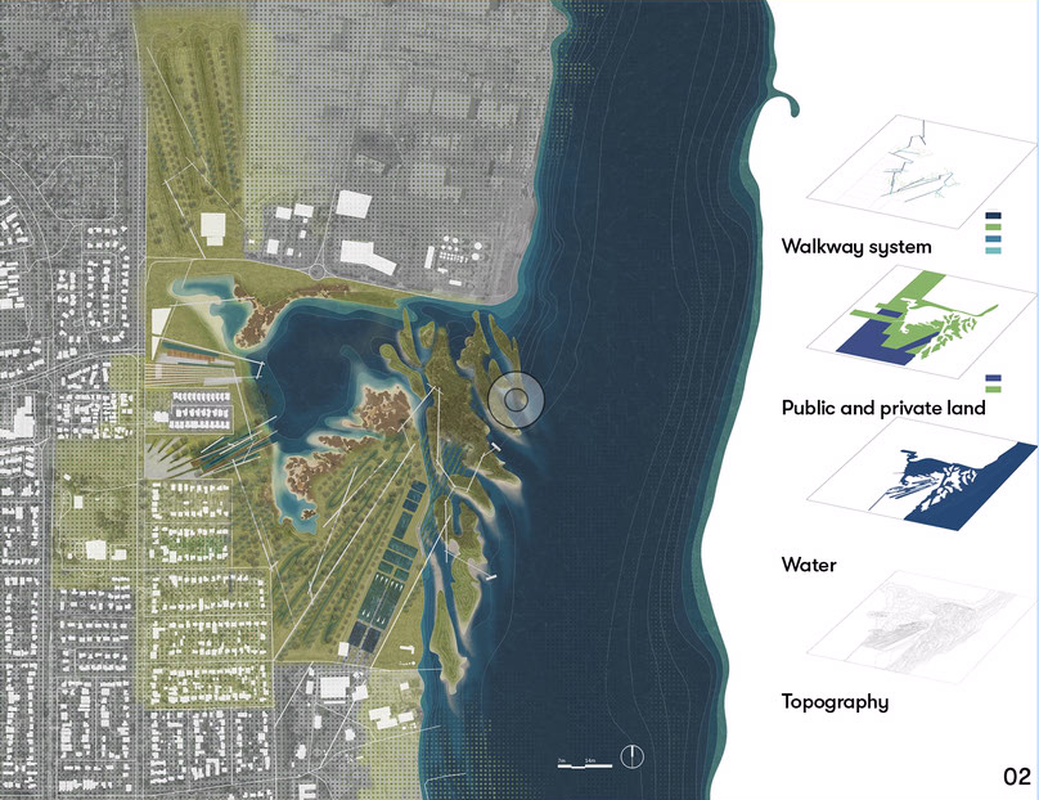
The Shape of Flow generates new landforms by simulating the natural flow processes within modified and natural tidal river flats. Digital and physical geomorphological models were built to gain insight into potential forms. The project proposes micro-topographic interventions to increase the stormwater storage area on land, reduce the impact of pollutants in the runoff and to develop a buffer zone to guard against tidal erosion caused by the river.
The landscape is divided into four types to manage the different flow and flood regimes and generate diverse habitats for colonization by future intertidal organisms. Although each landscape type has its own characteristics, together they build a complex trophic web that works towards restoring the Port River estuary and generates a novel ecology. The strategy alleviates current and future damage to the estuarine ecologies and reduces the risk of flooding from sea level rise, storm surge, tidal extremes and stormwater runoff.