Melbourne has a high number of level crossings compared to other cities in Australia, and they’re a major cause of road congestion and danger to pedestri ans. Removal of these crossings is a high priority for the Victorian Government, which plans to remove fifty of the most dangerous level crossings in Melbourne over the next eight years, with at least twenty removals by 2018. The level crossing at Burke Road, Glen Eris was recently removed, with the rail line lowered below the road, and other removals are currently under design or construction. Designs for the nine level crossing removals between Caulfield and Dandenong, on the Cranbourne–Pakenham line, feature elevated sections of rail and the transformation of “Melbourne’s busiest rail corridor into public open space.”
While generally there is community support for rail-under-road crossing replacements, plans for replacing these nine crossings between Caulfield and Dandenong with a “sky rail” have been met with concern by some members of the community and local government. Some have argued that elevated rail lines would create a public eyesore, pose safety concerns or divide communities. But while these plans have proved controversial, rail-over-road potentially provides not just many construction and operational advantages, but also urban design and public realm benefits that should be weighed carefully when assessing their value.
Beyond improving public safety and relieving traffic congestion by removing the barriers that level crossings impose, these projects also allow trains to run more frequently and open up possibilities for urban renewal – often including new or revitalized train stations. There may be opportunities to improve community connectivity, reconnect once-divided high streets and create new parkland and civic spaces for town centres. There are also opportunities to improve the quality of the long corridors of land between train stations.

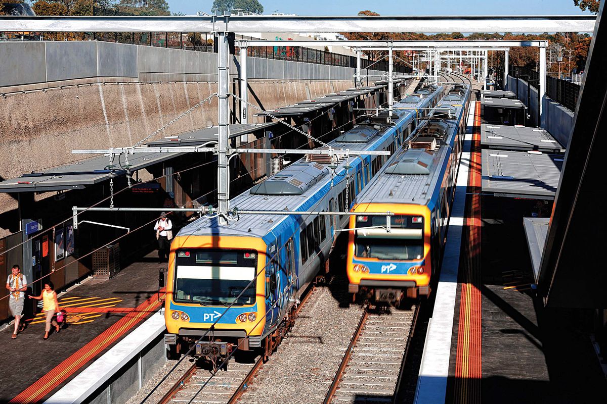
A complex level crossing at Burke Road, Glen Iris, involving a major road, train line and tramline, was removed via a rail-under-road solution, including the reconstruction of Gardiner Station below street level.
Image: Level Crossing Removal Authority
Lowering tracks below roads in cuttings, however, involves significant excavation and removal of established vegetation. The cuttings themselves take up space and are usually lined with shotcrete – an environmentally problematic material that is less than visually appealing. There are also project requirements to increase the capacity of station car parking, CCTV cameras (sensitive to tree canopies) and new signalling cable routes (sensitive to tree roots). Additionally, vegetation management guidelines suggest that new tree planting must be offset from the rail centre line by a distance equal to the mature height of the tree. This very conservative approach to safety and asset protection is not conducive to substantial revegetation.
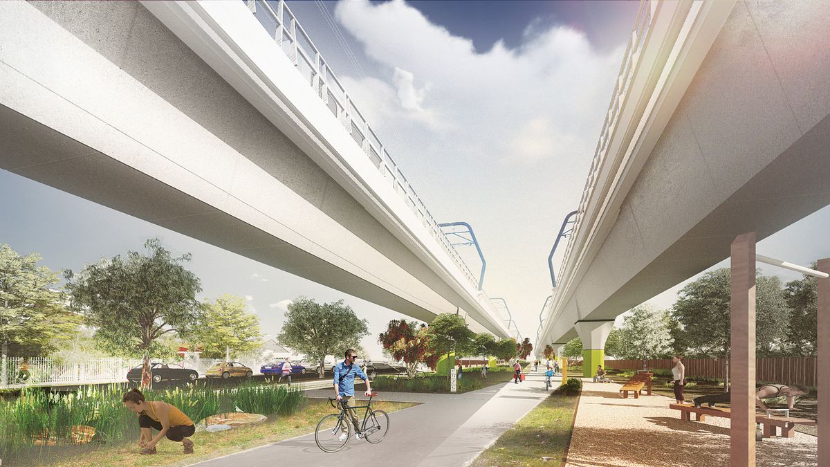
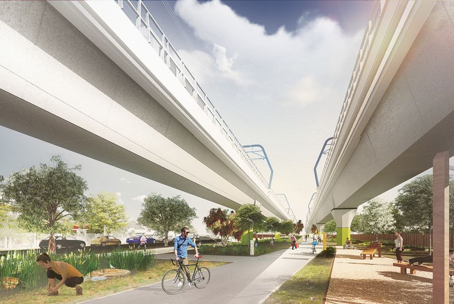
Elevating tracks above roads presents some issues and challenges, such as visual prominence and overshadowing and overlooking of some adjacent properties. However, with this approach there is less impact on existing vegetation and less ground-level land taken up by rail infrastructure. The spaces created can accommodate shared-use paths and public open space for recreation facilities, car parking and in some cases commercial or retail opportunities. Elevated rail also allows better connectivity between communities.

A linear park designed by Aspect Studios would be created underneath an elevated section of the proposed “sky rail.”
Image: Level Crossing Removal Authority
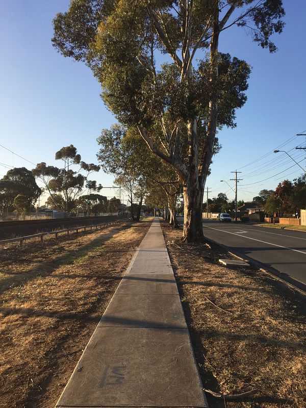
As our cities become denser and space more valuable, it’s time we unlocked the hidden potential of rail corridors. Regardless of whether the rail is over or below the road, rail corridors are undervalued spaces that have the potential to be more active, ecologically sensitive and amenable. Typically, corridors have buffers of unmaintained vegetation on either side of the tracks that vary in width and landscape quality. They are generally vegetated by an assortment of opportunistic weeds as well as remnant natural vegetation. In many of these areas there are valuable ecological corridors with established native trees and remnant protected grasslands, which have survived in spite of, or perhaps because of, their neglect. These corridors generally line the back fences of properties and are rarely considered part of the public realm, if considered at all – until recently.
Improving safe, off-road bicycle networks has brought into focus the significance of leftover linear spaces – such as creek corridors, freeway buffers and rail corridors – in linking our suburbs. Government agencies are now committed to providing cycling facilities wherever major transport infrastructure investments are being made. The level crossing removal projects are no exception, and shared-use paths are being implemented along the corridors of all projects. This is a positive inclusion – transforming these linear spaces into connected, active-transit corridors. It also means the corridors need to provide a more interactive landscape experience than before.
With their elevated status as spaces for active transport, car parking and stations, it is now more important that these corridors are not considered as leftover space and are instead given attention to reach their full potential in providing better visual amenity, ecological contribution, water sensitive urban design, shade and heat island reduction. The sensitivity surrounding the Caulfield to Dandenong rail corridor project and others like it places an imperative on delivering truly valuable landscape solutions – handled properly, these projects could create more attractive, liveable and sustainable urban communities along the rail corridor.
Source
Practice
Published online: 15 Sep 2016
Words:
Craig Guthrie
Images:
Craig Guthrie,
Level Crossing Removal Authority
Issue
Landscape Architecture Australia, May 2016