The Goolarabooloo community have led the Lurujarri Dreaming Trail along Western Australia’s Kimberley coast, north of Broome, since 1987.1 The trail follows the land of the traditional song cycle for 80 kilometres along the beaches, dune systems and red sand bush. It is land that has been home to Aboriginal people for millennia – the same trail, the same camping places, the same fishing spots. Middens are filled with remnants of past food; and artefacts, including spear heads, charcoal, flints and grinding stones, are testament to the longevity and continuity of law and culture.
Established by retired Aboriginal drover, Goolarabooloo senior lawman and storyteller Paddy Roe, the Lurujarri Dreaming Trail was initiated as a way to ensure the Goolarabooloo community were able to continue walking Country, in doing so ensuring connection, renewal and preservation of culture and heritage through the practice of traditional skills. Roe also sought a dialogue with non-Aboriginal people through the Lurujarri Dreaming Trail, a dialogue based on and fostered through trust, empathy, friendship and an understanding of our shared relationship with land. Current trail leader, general manager of Goolarabooloo Corporation and Paddy Roe’s great grandson Daniel Roe continues that tradition, with his trail team of community members and volunteers. Central to this is the exchange of knowledge – most importantly, across generations – to ensure that knowledge is not lost but is exchanged through Country.

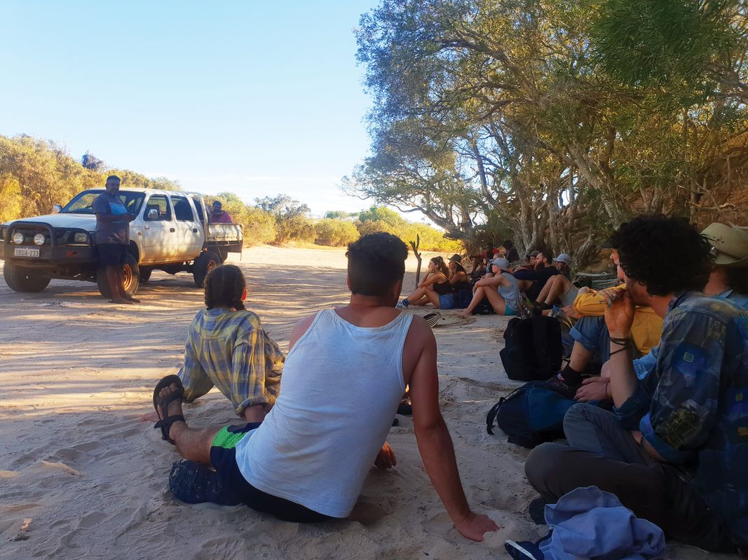
RMIT University students engaged in knowledge exchange with trail leader and general manager of the Goolarabooloo/Millibinyarri Indigenous Corporation, Daniel Roe.
Image: Jock Gilbert
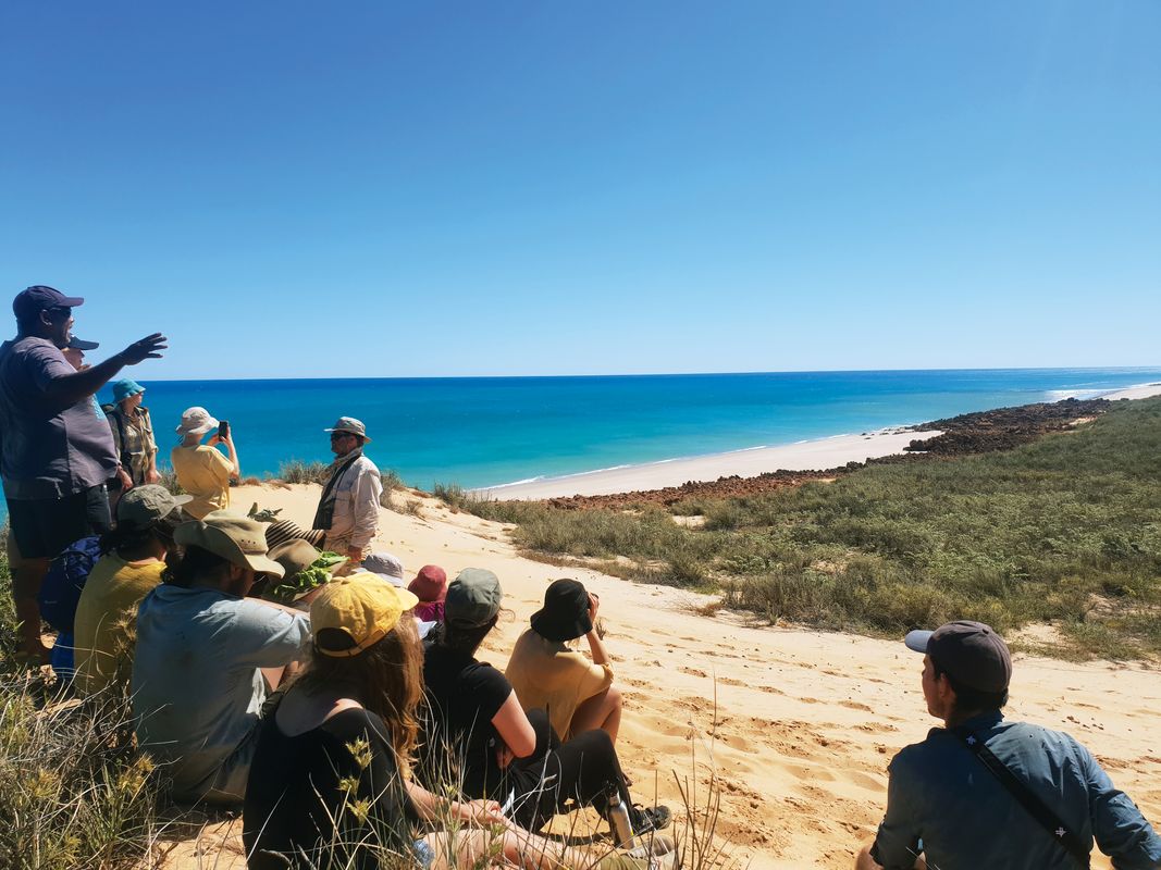
Students and staff from the landscape architecture discipline at RMIT University have participated in walking the trail each year since its formal inception. In 2019, I led the student group as an academic in the program. The walk presents an opportunity for students to experience the landscape of the region in a way that is unmediated by conventional educational frameworks. The trail invites participants to walk the stunning and seemingly endless beaches north of Broome, accompanied by community members who tell the stories of the landscape along the journey. The beach walking is interspersed with excursions though the dune systems and camps in the low bush in the lee of the dunes. Without direct reference, all participants are gradually inducted through landscape into a sense of Country – a sense of Australian ethnographer Deborah Bird Rose’s “nourishing terrains,”2 through which one becomes aware of one’s connection to a far greater reality – the Bugarregarre (the Dreamtime). The Bugarregarre is the means through which ancestors are animated, creation stories are realized and law is encoded in the song cycle. Dinosaur footprints 130 million years old, cast in sedimentary rock on the shoreline, correlate with these creation stories of humanity emerging from the water to become terrestrial. Bugarregarre confirms scientific stories on trail, landscape becomes Country through the song cycle as participants become enmeshed in the interrelatedness of the present, the (deep) past and the future.
The landscape of the trail – the song cycle – includes country on which it was proposed in the mid 2000s to build a huge onshore gas-processing plant to service off-shore drilling at one of the area’s headlands, James Price Point. In support of this proposal, the then WA Premier Colin Barnett described this landscape as an “unremarkable” piece of land, to which the addition of a massive industrial plant would do no harm, arguing instead for the economic benefits to the local population such a project would bring. While the gas-plant project was ultimately shelved, Barnett’s position at the time arguably denied any sense of what we might consider to be broader landscape values, as well as ascribing no value to the song cycle as a way of understanding the world. In a sense though, Barnett’s position arguably springs from a landscape tradition that posits the landscape as a thing on which humanity might act. Such a tradition rendered impossible the sense and experience of interconnectedness described through Aboriginal creation stories in the reality of everyday life. The Lurujarri Dreaming Trail invites us, as built environment practitioners, to rethink our relationship to the world, through a shared experience of that world, moving from landscape towards Country while simultaneously moving through (the) landscape and (on) to Country.

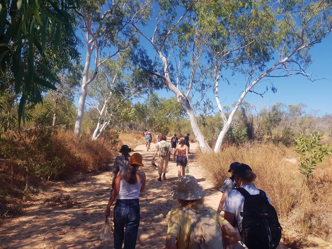
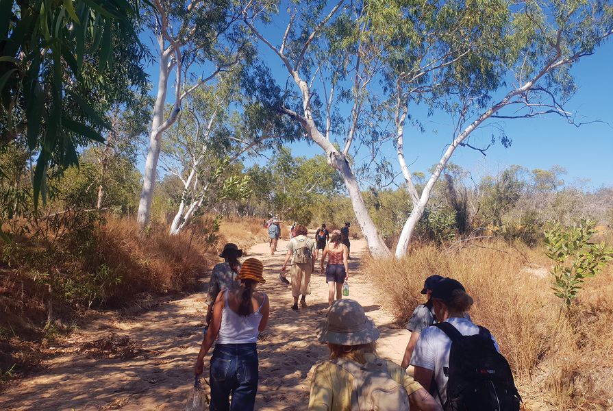
Participants walk the beaches and dunes accompanied by community members who unfold the stories of the landscape along the way.
Image: Jock Gilbert
The Lurujarri Dreaming Trail is walked in July – the season of Barrgana, one of the six seasons of the Goolarabooloo and the time when the dugong are fat. Barrgana is often dry but can also be the season of Mujung or “knock-em-down rain,” rain which falls heavily enough to flatten grass, but with not enough volume to fill waterholes. Walking the Lurujarri Dreaming Trail with Daniel and his mob, water is ubiquitous – whether avoiding the tides as one traverses the endless beach, negotiating rock pools in pursuit of the perfect fishing spot, slopping through mangrove mud in search of mud crabs or seeking to overcome the perpetual thirst generated by walking in a subtropical climate (albeit in “wintertime”). Several other “types” of water become apparent through this country and its stories. Jila is the most prized water source, least encountered and often of sacred significance. Jila is permanent water that persists throughout the seasons and must be preserved. Bilara is seasonal fresh water that persists after the rainy season but doesn’t last long, while Ingu is another form of water that persists after the wet season, but lasts longer – usually as a spring. Uban describes water that is sometimes brackish and always found on the edge of saltwater or the liminal zone between fresh and saltwater. All these water types have their specific uses, offering up particular food sources, quenching thirst, sustaining life in different ways, and all are dependent on seasonality and particularities of place.

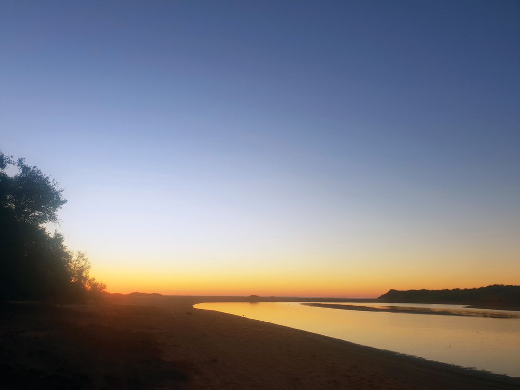
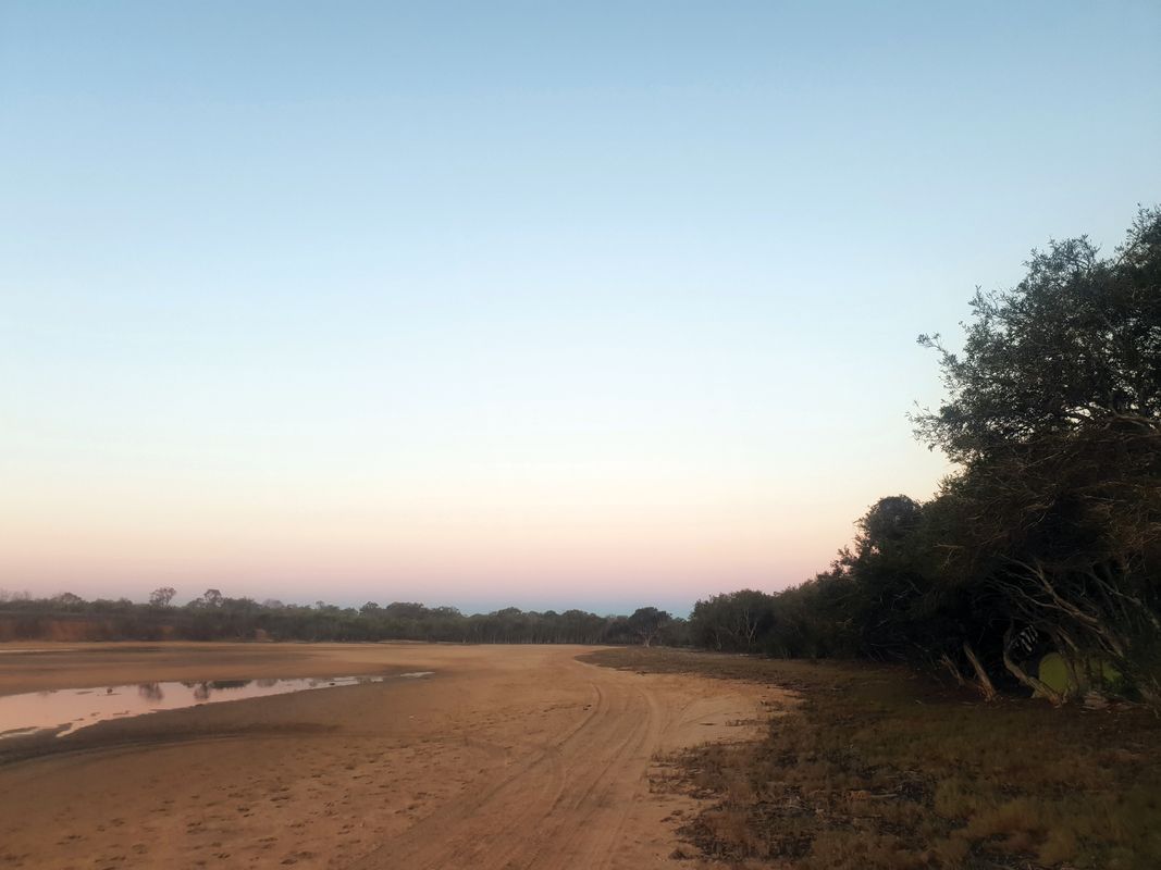
Along the coast north of Broome, the trail winds through red sand and bush, past points where freshwater and salty ocean water meet.
Image: Jock Gilbert
As a non-Aboriginal person first embarking on the Lurujarri Dreaming Trail, the landscape is experienced primarily in its relationship to the enormity of the ocean that one walks adjacent to. It is a landscape of awe, far removed from Colin Barnett’s “unremarkable” piece of land. Through stories, listening and a gradual reading of place, one becomes aware of the very subtle nuances around all of the interconnectedness which constitutes this – one moves beyond landscape and into a relationship with Country. The trail affords the opportunity to accept great grandfather Paddy Roe’s beautiful invitation: “You people try and dig little bit more deep – you bin digging only white soil – try and find the black soil inside … ”3
1.Goolarabooloo – Lurujarri Dreaming Trail website, http://www.goolarabooloo.org.au/index.html (accessed 20 February 2020)
2.Deborah Bird Rose, Nourishing terrains: Australian Aboriginal views of landscape and wilderness, Australian Heritage Commission, Canberra, 1996.
3.Krim Benterrak, Stephen Muecke and Paddy Roe, Reading the Country: Introduction to Nomadology, re.press, 2014.
Source
Practice
Published online: 22 Jun 2020
Words:
Jock Gilbert,
Daniel Roe
Images:
Jock Gilbert
Issue
Landscape Architecture Australia, May 2020